As I mentioned in last Thursday’s post, I took a little detour on my way from Walla Walla, Wash., where I was visiting my parents, back to Portland, Ore., where I would get my flight home to St. Louis. My husband, Barry, and I went to La Grande, Ore., to visit the Grandview Cemetery.
I’d read on a US GenNet cemetery index that my great great great grandfather, Thomas Washington Nebergall, was buried at the Grandview Cemetery, in Block 113, Lot 1, Space 5. His next of kin was listed as his wife, Miriam Van Bibber Nebergall, which matched my records. So I figured that was my guy and that a visit to the cemetery might provide me with some verified information about him (of which I have precious little).
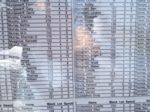
We drove the winding roads through the Blue Mountains to La Grande (part of the time we were actually on the Oregon Trail) and managed to find the small cemetery. We found Thomas’s name in an index (pictured), in a big display case with a map. But when we went to Block 113, there was a lot of open grass and only one Nebergall grave stone, despite there being five Nebergalls on the index in that block.
We searched in vain in the hot sun for more Nebergalls and before giving up I telephoned the cemetery office. The gentleman there gave me the only explanation I’d been able to think of, which is that no grave stones were ever made for them. My hopes for finding more info about my grandfather’s great grandfather at the cemetery were dashed.
I was disappointed, but, as Barry reminded me, it’s just all part of the adventure. The search in and of itself is fun (though it’s made more sweet by some great discoveries). I’m confident that eventually I’ll get the information I seek. And I’m not letting it discourage me from looking at more cemeteries! I have many ancestors buried in the state of Missouri, so I expect some road trips before too long.


Unmarked graves are far more common than one realizes. A grave photographer friend who volunteers with Find A Grave has an app he uses when going to the cemetery, which pinpoints the geographical coordinates of latitude and longitude of a grave location. Of course, he has a cemetery map to locate the burials in the first place. One can post these coordinates on Google maps, or on the person’s memorial on Find a Grave, and when clicked on, they will show an aerial map of the geographical location on Google maps, or one could enter the coordinates into the Google map search. When he takes the photo, he edits in arrows pointing to the approximate location of the burial. When I take “unmarked” photos, I simply highlight the approximate area of the grave using a different color shape or some such thing. some larger cemeteries may have online interactive grave maps to help find unmarked graves.
Thanks for commenting, Cathy. And thanks for being a Find A Grave volunteer. It’s such a generous activity!!